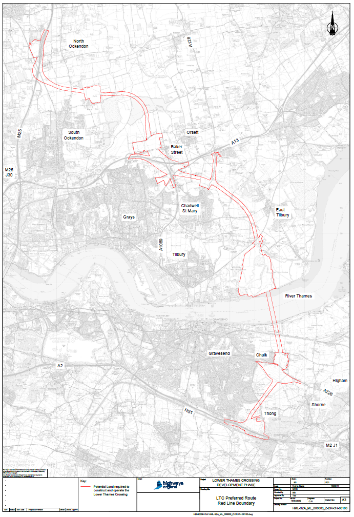
Option C Route 3 Corridor Map
Option C Route 3 Boundary Map
This map details the boundary or corridor of Option C Route 3.
We expect there to be slight variation to this as and when Highways England provide further engineering detail for each of the sections.

If you wish to print your own copy or view on your computer at any time, please use the pdf link here > Red line map

